Recent satellite photos show that irrigation reservoirs in some of North Korea’s most important agricultural regions have more water than last year.
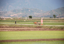
High-resolution SkySat satellite photos taken on Apr. 25 show that North Korean farmers are preparing for the spring planting season by creating seedbeds and, in some areas, the irrigation process has already begun. Once the irrigation process is complete, the seeds in the seedbeds will be moved to farm fields for planting.
The satellite images reveal that the level of irrigation reservoirs in major agricultural areas such as Anak County (South Hwanghae Province), Sangwon County (North Hwanghae Province), and Jungju County (North Pyongan Province) is relatively high, and that there has been an increase in the area covered by these reservoirs. This suggests that the country’s supply of water for irrigation may be better than last year. Typically, North Korea’s rice planting season starts in early May and ends in mid-June. Sometimes, however, the season can last until late June or even early July depending on climate conditions, such as droughts.
In 2020, North Korea’s food production suffered due to monsoon rains and typhoons in July and August. This year, however, the country’s food situation may improve somewhat because of higher amounts of water in irrigation reservoirs.
The author of this article is a former researcher at the Korea Group on Earth Observation.


