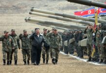
[imText2]As North Korea experiences hardship from the flood disaster, news informs that that the military has also been mobilized to assist the restoration work.
The Red Cross informed that 450,000tons of granary had been damaged and 300,000 persons displaced following the 5 day torrential rainfall that began on the 7th in North Korea.
North Korea has been continuously reporting Pyongyang’s flood situation through the media. North Korea’s Chosun Central TV reported that two famous restaurants in Pyongyang, the Choengryu-kwan and the Ahnsan-kwan had closed doors having been submerged in water and news of the Botongkang-district and Daedong River areas are being reported every day.
North Korea’s Central Meteorological Institute even revealed that the recent flood disaster had been the worst in 40 years since the last massive Pyongyang flood in August, 1967. From August 25th, 1967 until the 29th, North Korea saw a total rainfall of 472mm whereas the recent downfall saw an additional 52mm, totaling 524mm of rain.
With this amount of rain, most of the major cities in South Korea would also be inflicted with severe damages.
Even in the 1967 flood, an average of 470mm rain fell on the lower and mid-streams of the Daedong River leaving Pyongyang and Dukcheon, Sooncheon, Yangduk and Sungcheon in South Pyongan, and Shinpyong in North Hwanghae immersed in water.
At the time, the paths and roads in Pyongyang were covered in water that Kim Il Song went out on his boat to inspect the flood disaster locations. As for the region of Hamheung, South Hamkyung where Kim Jong Il is known to be currently residing, a total of 336mm of rainfall was known to have been reported.
[imText1]New China News Agency captured footage of trees and reserves along the Botong River submerged in water on the 15th as well as lamp stands immersed in water along the paths near the Daedong River and released these footages in Pyongyang. In particular, a footage of Kim Il Song Square located in front of the Grand People’s Study House was taken from the Daedong river. The area was surrounded by water.
Some criticize that the severity of North Korea’s flood damages rests on the shoulders of a poor administrative system.
The reason that the water levels of the Daedong River which passes through Pyongyang rises rapidly is due to the fact that there are no longer any forests. During the food crisis of the 90s, mountainous regions such as Dukchoen, Bukchang, Yangduk and Maengsan in North Pyongyang were all stripped bare to be used as farmland. Today, these mountains stand barren.
Any hill more than 60 degrees steep was under cultivation into terraced farms. People then planted food to eat. These forests which acted as a blockade to landfall were devastated and as rainfall poured onto the ground, earth and sand was merged tumbling towards the river.
As this mixture of earth and sand slid towards the Daedong River, every year the riverbed rose reducing the gap between the surface levels of the river and nearby farmland. For many years dams were under the same situation as rivers. The water volume of dams was diminished for the piled sand on the ground of reservoirs.
The waters along the lower streams of the Daedong River are rapid and as a result, even with a small amount of rainfall, the waterbeds rise quickly. In addition, as the earth is mixed with the rising water levels, flooding is inevitable in situations as the recent disaster.
Some blamed the Western Sea Sluice, which is the biggest sluice in North Korea at the mouth of the Daedong River, for the cause of Pyongyang’s flooding. The water needs to flow freely towards the sea, however the Sluice was constructed too narrow and as a result, some of the water flows backwards falling onto the nearby farms and flooding the land.


